July 29th to August 10th!
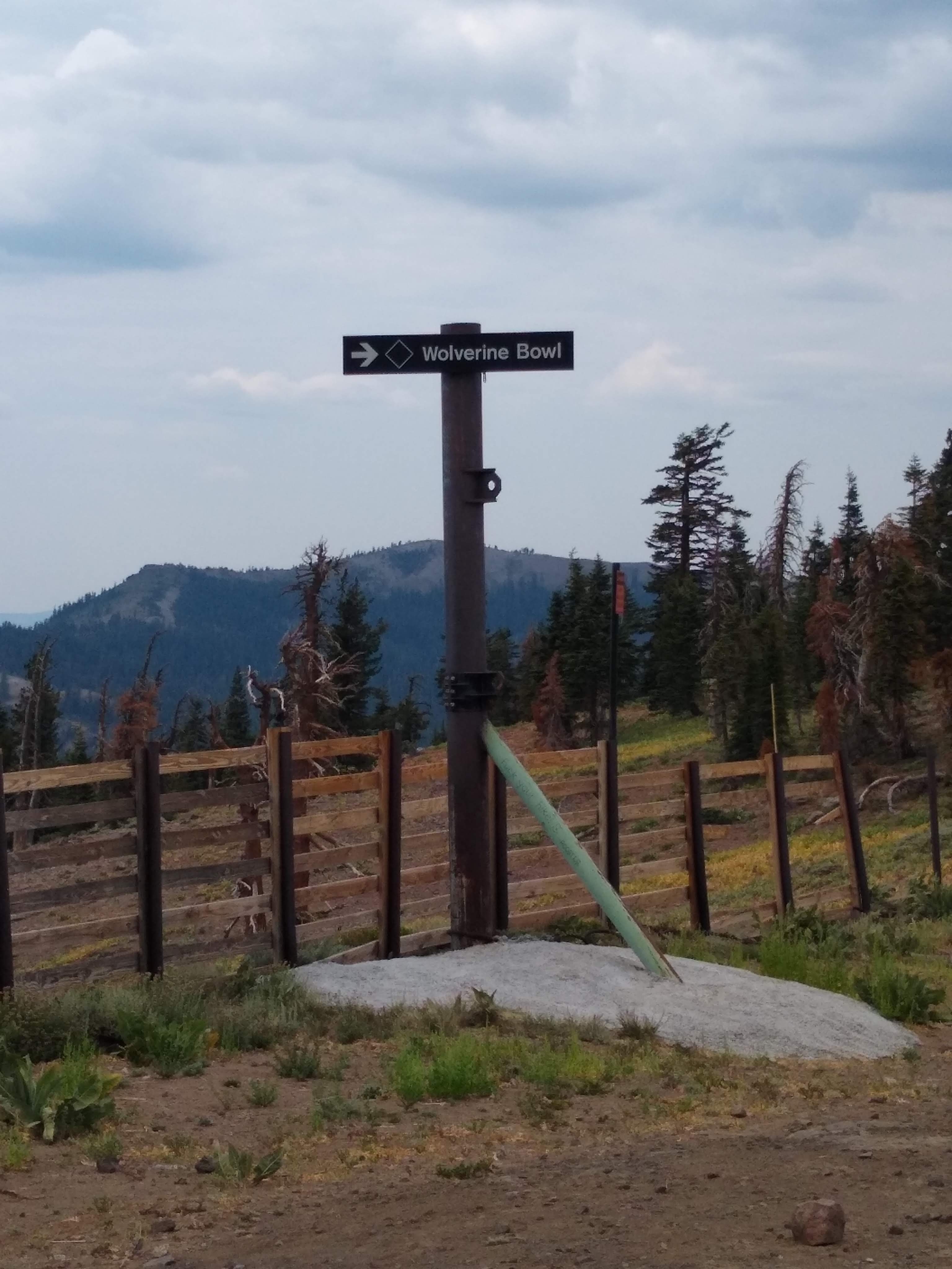
The 30 mile hike from Barker Pass to Donner Pass was successful! We planned for three days to accommodate my knee, but did it in two 15 mile days. We met several Sobo (southbound) hikers who kindly let us know we were late heading north as well as several very welcoming bikers and day hikers from the Truckee area who wanted to make sure we didn’t need a place to stay. “We’re good”, we told them all…”we have a plan.” Our 30 miles traversed the Desolation Wilderness and Granite Chief Wilderness areas, including several ski resorts (including Sq*** Valley and Sugar Bowl). Beautiful, beautiful high pink granite peaks. No snow.
We camped in the Sq*** Valley (hereafter known as Square Valley, in my mind–why not?) Ski Resort, next to a secret little creek hidden under the willows.
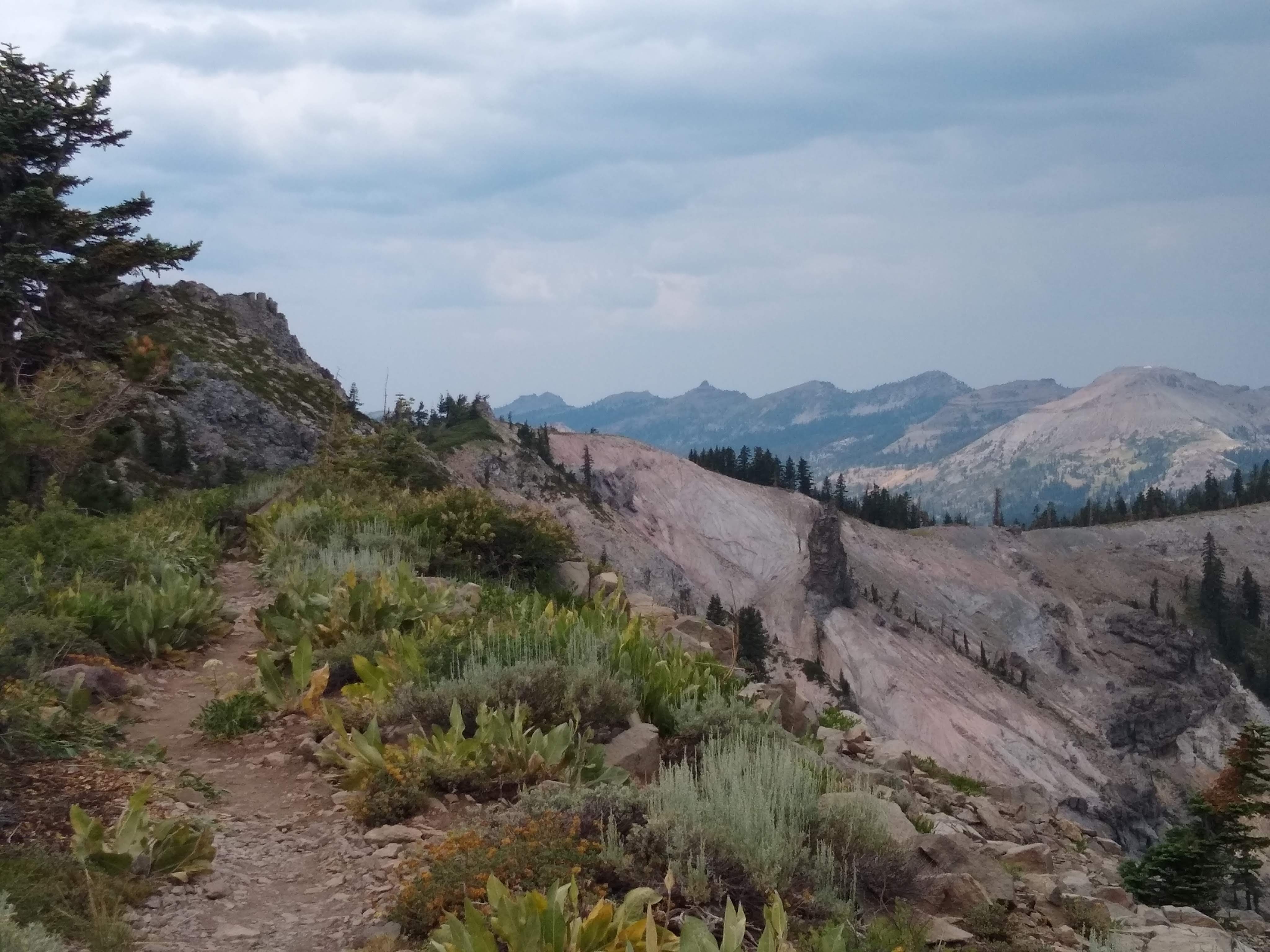
The next morning we leapfrogged with a group of section-hiking young men, climbed around Tinker’s Knob and had this stunning ridge walk:

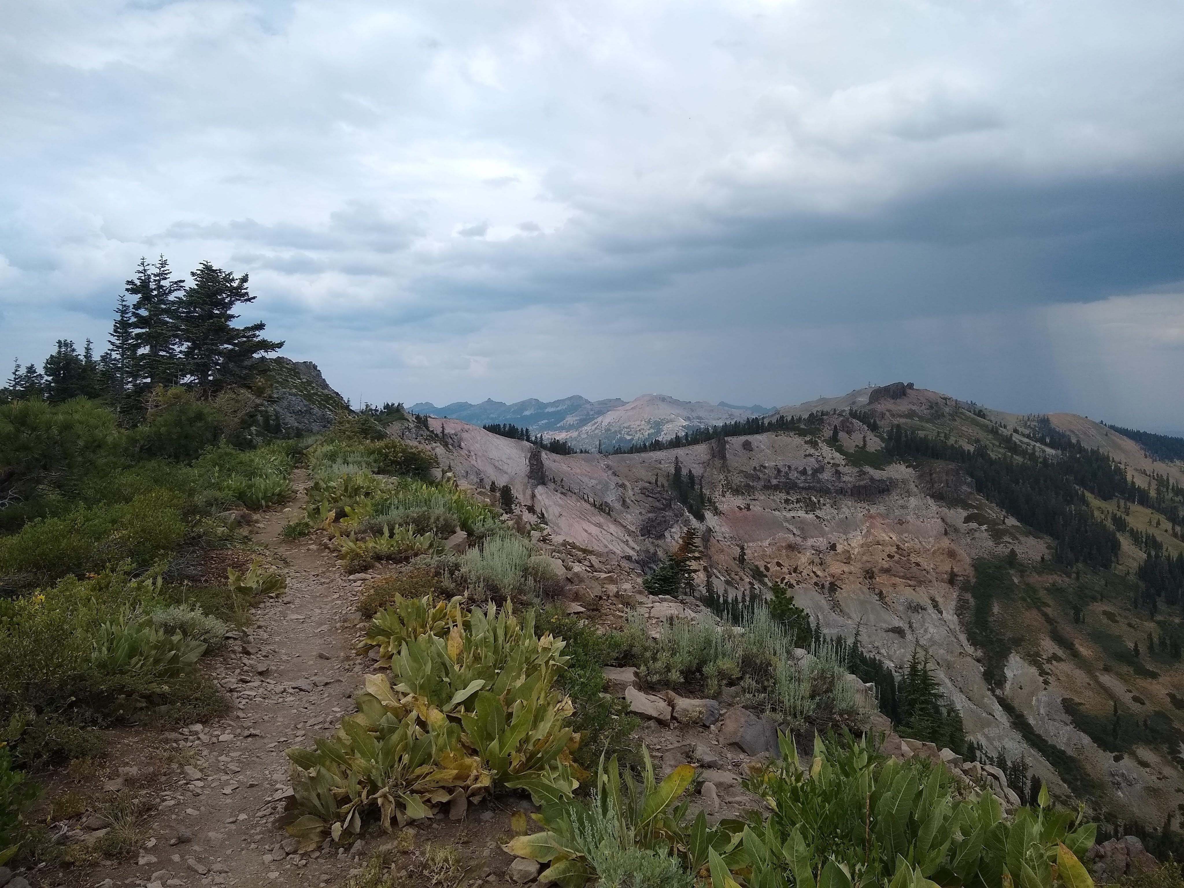
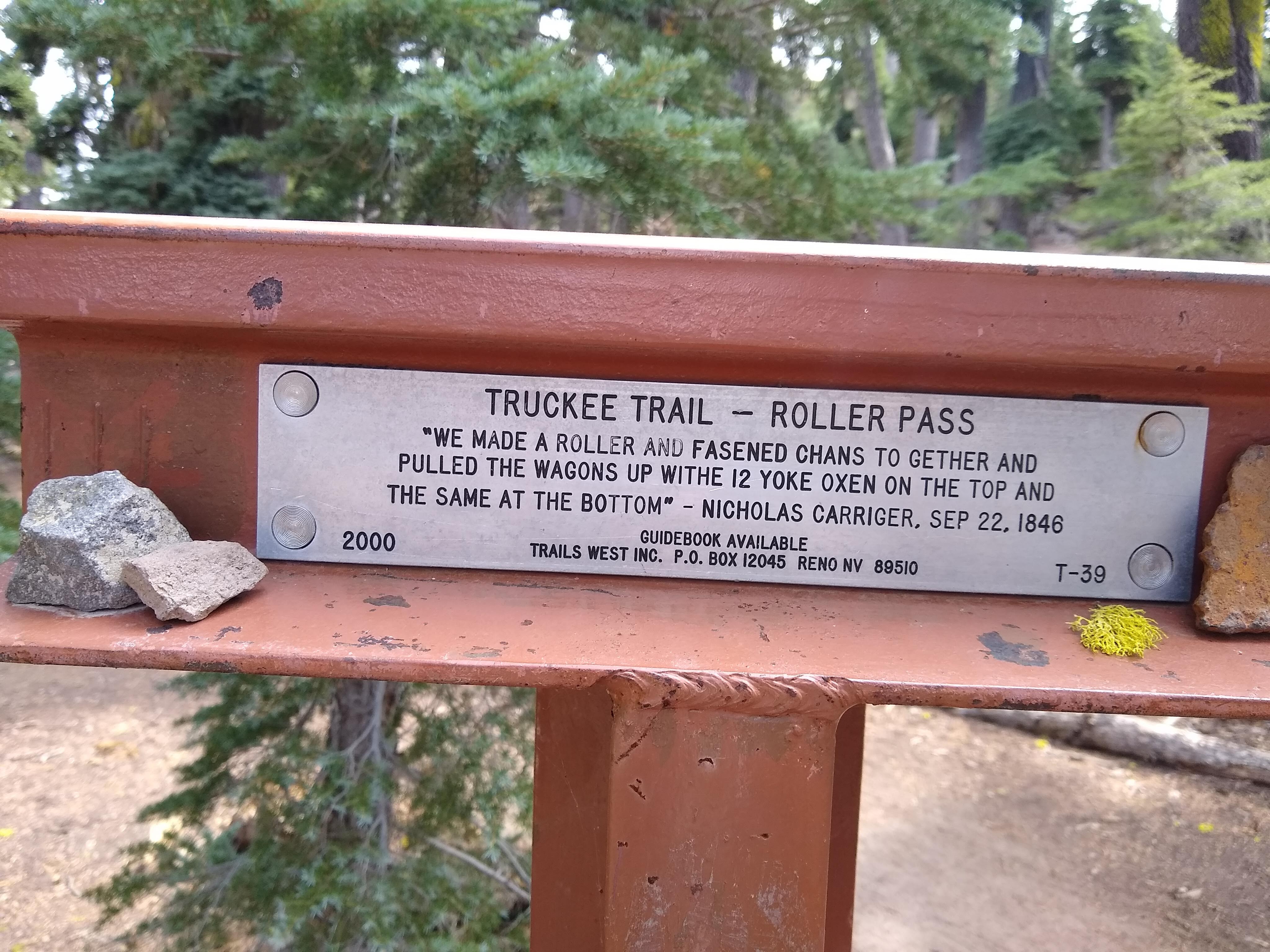
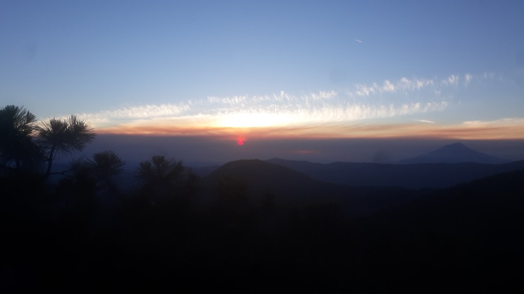
Our last pass of the second day was historic “Roller Pass”:
And then! An everlasting descent down rough trail into the Truckee area, and up another four or so miles of rolling granite, a little way finding, and we were at Donner Pass. Found the car at the Eastbound I-80 rest stop, scuttled back down to Barker Pass to camp overnight in the truck and started the long journey up I-5 the next morning with both vehicles, skipping around the still raging Dixie Fire near Hwy 89, Chester and Lake Almanor, where the PCT had been closed for several weeks. We parked a car near Castle Crags at the PCT trailhead and headed back down to the Burney Falls area to start hiking again. Yes, there was a stop for ice cream at Burney Falls.
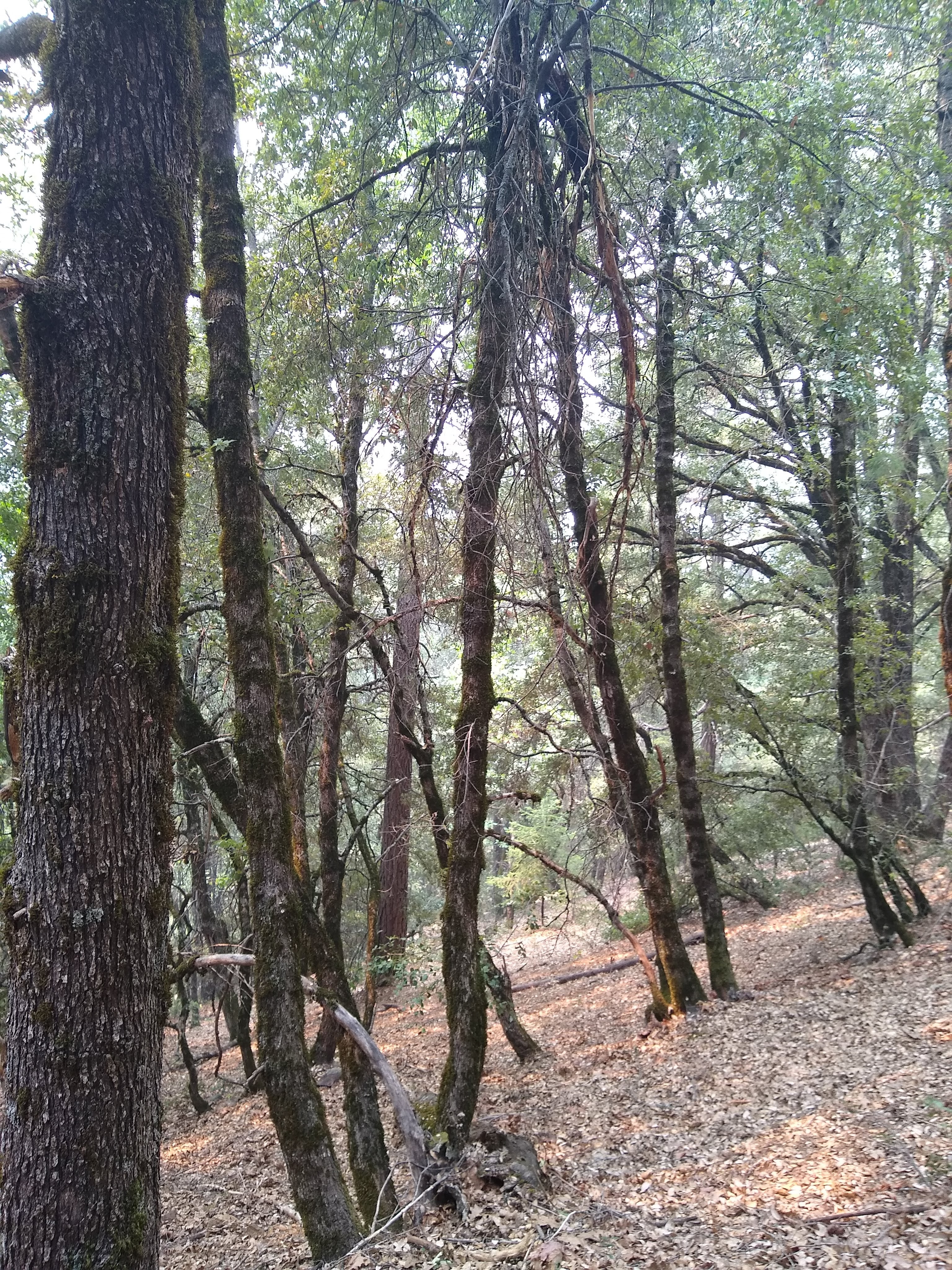
We were now at about 4000 feet as opposed to the 8000 foot elevation of the Desolation and Granite Chief Wilderness areas. It was HOT. What a different terrain; steep wooded canyons, tarbrush, manzanita, kinnikinnick, firs, some ponderosa…and poison oak–lots and lots of poison oak. And ground bees. Take it from the new expert–when bees creep into the sleeve of your t-shirt, do not hop around squeaking and flailing at yourself (yep–five stings).
And bears. We’d been warned that a bear and her cub were in the vicinity, so we hiked along singing Irish bar songs (well known strategy for bear deterrence!) and sure enough, spooked a small mama and her tiny cub. They thrashed across the trail right in front of us; we kept walking and singing after giving them a little room to feel comfortable.
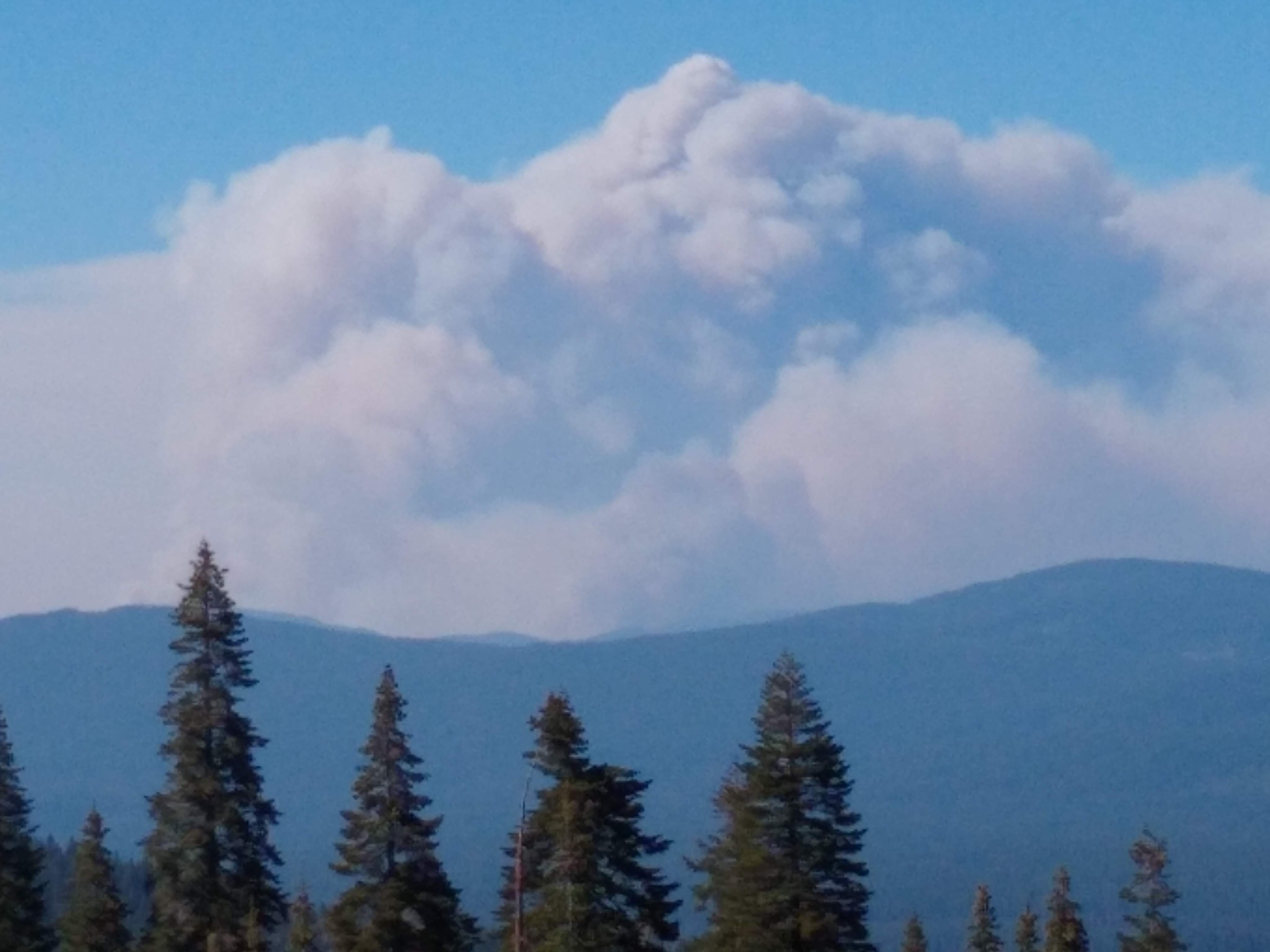
We opted not to camp at the little muddy creek where there had been a recent cougar sighting and headed up, up up to a ridge with promised views of Mt. Shasta. We arrived as the smoke (from the Antelope Fire) started rolling in:
The next day was clear! The PCT wandered up and down many more wooded canyons, and made a brief, startling, three mile traverse of a private timber operation (featuring speeding log trucks on forest roads, lumbering skidders right next to the trail, piles of recently felled trees). After a few calming miles of sunny, meandering trail, I topped a hill and looked up at the small ridge ahead of me and saw…a cloud? A smoke plume? Definitely a smoke plume.

The ridge made it difficult to know how far a way the plume was. Chris’ phone had service. There was a text to our friend recently retired from CalFire (thank you Sharon and Hugh!) There were a few calls to the local NFS office…there was the additional stumbling across a crowdsourced warning about three foot gaps in the trail coming up on a steep hillside. There was some worry, oh yes.
We proceeded. The sandy trail gaps were easily tiptoed over (nothing like the gaps in the steep granite trail near Sierra Buttes) and the smoke plume turned out to be from the Antelope Fire several ridges (and many miles) away. Perspective is everything. All was well.
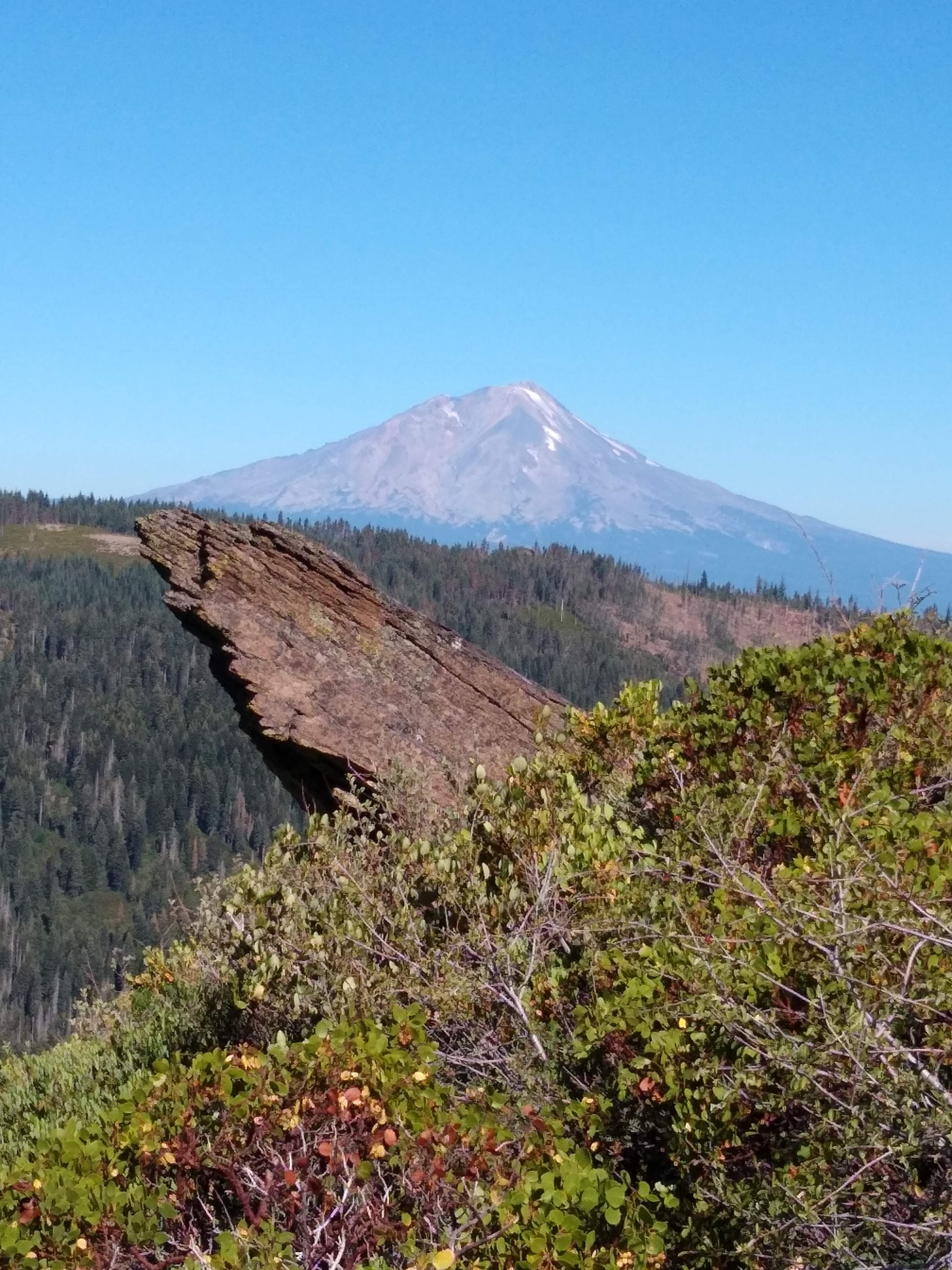
A nice camp near another tiny creek, a huge climb the next morning, and there it was–Mt. Shasta!
The remaining two days were in the smoke. We slowly dropped elevation, getting into forests of black oak, had a lovely dip in Sq*** Valley Creek, and eventually got to the long, (smoky) descent towards the Sacramento River.

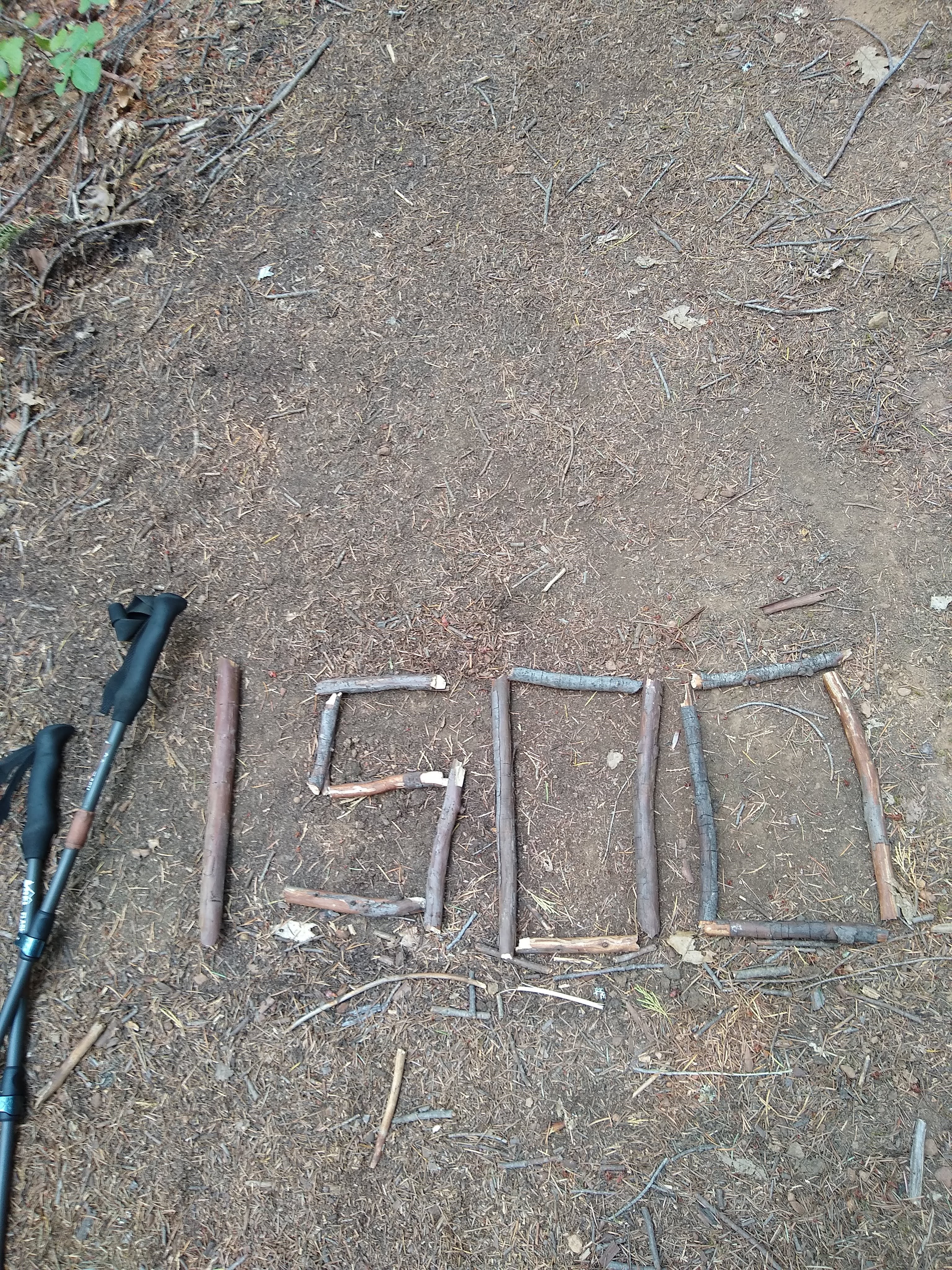
And, what’s this? Because of the fire skips, we’re at mile 1500!
Whew! A quick dip in the Sacramento River, a little drive to retrieve the truck, a salad (oh joy), a couple nights in a motel in very smoky Mt. Shasta City, a little visit to the city library for the last of my sabbatical research, more groceries, laundry, and confirmation that the PCT is closed for another 100 miles due to the River Complex Fire just north of Mt. Shasta. The last 30 miles of trail between the closure and the Oregon border will be about 108 degrees in the next few days. That’s it. We’re skipping up to high elevation Oregon at the state border and taking eight days to hike up to Crater Lake–where we left off our PCT hike last summer!
